
Updated on October 11, 2026
Kayaking on Rivers, lakes, and Port Phillip Bay
Finding places suitable for kayaking in and around Melbourne is quite easy. The Yarra River and Port Phillip Bay offer excellent paddling, and the small lakes are ideal for a quick paddle and some practice runs.
The Great Ocean Road offers some excellent paddling spots, and the rest of Victoria has dozens of places to explore by kayak, too.
If any of the information below is incorrect or rules have changed, please let me know.
▪︎Aura Vale Lake, Selby
- Location: Wellington Road, Selby
- Parks Victoria information
- The park gates are locked at sunset, and open at sunrise.
- Paddle distance around the lake: 2.58 km approx.
- Swimming – Not officially.
- Toilets – Yes
- Dogs allowed – Yes
- Shade and picnic tables: Yes
- BBQs – No
- Cafe – No
Years ago, in fact, last century, horses were allowed in the lake, and we used to take them down from Menzies Creek on the far side of the lake to swim. It is now used mainly for unpowered watercraft and fishing.
Aura Vale is a pretty little lake on the edge of the Dandenong Ranges, created in 1973 at the same time as the Cardinia Reservoir water catchment. Bright yellow water lily flowers adorn the water’s edge, with plenty of bird life, native bush on the far side, and a few paddocks stretching off into the distance.
The only downside to Aura Vale Lake would be the constant traffic noise from Wellington Road, but it tends to fade into the background once you’re paddling and absorbed by the pretty surroundings of the lake.
▪︎Lysterfield Lake Kayaking, Lysterfield
- Location: Horswood Road, Lysterfield
- Parks Victoria information
- The park gates are locked at sunset, and open at sunrise.
- Kayaking distance around the lake: 4.49 km approx.
- Swimming – Yes!
- Toilets – Yes
- Dogs allowed – No
- Shade and picnic tables: Yes
- BBQs – Yes
- Café – At the entrance to the park is a fabulous café and restaurant.
Lysterfield Lake is an excellent spot for paddling, and it’s also a popular destination for hikers, mountain bike riders, sailboats, swimming, and picnicking.
The lake is quite large and open; the top end has some interesting areas to explore, and a few wooden jetties are dotted around, providing mooring points if required—plenty of birdlife to be seen, along with occasional Kangaroo sightings.
▪︎Lillydale Lake, Lilydale
- Location: Swansea Road, Lilydale
- Website information
- Open 24 hours.
- Paddle distance around the lake: 2 km approx.
- Swimming – No.
- Toilets – Yes
- Dogs allowed – Yes
- Shade and picnic tables: Yes
- BBQs – yes.
- Cafe – Coffee, ice cream and snack vans usually operate daily.
Lillydale Lake is a highly popular park with easy access to the lake for activities such as kayaking. A couple of little islands provide a bit of interest to paddle around, plus distant views of the Dandenong Ranges. There is a terrific kiddies playground and water park, a walking trail going around the lake, plus a few other trails leading off and an off-lead dog area by a creek where dogs can swim.
▪︎Kananook Creek Kayaking, Frankston
- Location – Frankston
- Launch Points – Frankston Boat Ramp, Kananook Creek Canoe Launch, Seaford,
- Paddle distance return: 18.5 km approx.
- Swimming – Not recommended.
- Toilets – Frankston boat launch.
- Dogs allowed – Yes
- Cafes/restaurants – Frankston waterfront, upstream at Riviera Hotel or the Spanish Bar in Seaford, both of which are by the water and easily accessible or pack a picnic as a few spots are available to stop for a while.
Kananook Creek has been on my list for years. Launching at the Frankston boat launch, it was fun kayaking up to where the Mornington Peninsula Freeway crosses the creek.
Passing by waterfront homes with fabulous private boat launches, decks and gazebos. There is plenty to see, including bushland and quiet areas, although the background traffic noise is ever-present.
The waterway is shallow in many sections, with bridges, a rubbish collection barrier and a fun tunnel through huge concrete pipes. One bridge was particularly low, and the water level can sometimes be too high to pass under at this spot.
The canoe launch in Seaford is a good spot to stop for food; the Spanish Bar looks fun, or the Riviera Hotel, and a few picnic places are dotted along the way for a self-catering munch stop. Despite passing through suburbia, this is a fun kayaking spot, with plenty to see.
Take note of the tide times and paddle up on an incoming tide, ideally. The return is a bit easier on an outgoing tide or high tide, but not too hard if the tide is still rising.
▪︎Patterson Lakes – Christmas lights
Kayaking around the homes of Patterson Lakes at Christmas time is fun. Many of the residents go to great lengths to bring festive cheer to the area. Viewing from the water level is the best way to enjoy the lights.
It is approximately 8 km to paddle around all the inlets, and this route can be extended further by exiting onto the main Patterson River and exploring other areas, passing through the floodgates. Check on a maps app to see the entrance points.
From the Patterson River boat launch area, where there is plenty of parking, kayaks/canoes/boats can be launched from a small sandy beach to the left on entering the car park or drive to the far end to use a regular boat ramp where it is a slightly shorter paddle to see the lights and also avoids going past the other launch ramps that can get busy. Public toilets and BBQs are also available at the far end.
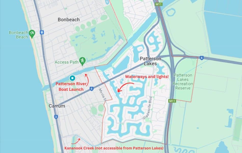
- Location – Patterson Lakes, approx. 49 km South East of Melbourne CBD.
- Launch Points – Patterson River boat launch
- Paddle distance return: 8 km approx. (no need to go all the way).
- Swimming – Not recommended.
- Toilets – Located at the far end of the boat launch, along with a BBQ area.
- Dogs allowed – Yes
Once launched, head upriver briefly, then turn right through the flood gates – keeping to the right-hand side. The wake from boats can be fun, but it can also get paddlers wet, even though they are all speed-restricted to 5 km per hour.
The paddle does not need to be lengthy, as homes decorated with Christmas lights are visible as soon as the paddle starts, once you’ve entered the waterway. We paddled into most of the coves and had a fantastic time, with lights on our boats and snacks along the way. Make your Christmas lights kayak paddle as long or as short as you want.
Make sure your kayak or canoe is equipped with lights that can be seen from all directions. I splurged and bought a RailBlaza navigation set-up. The complete kit comes with a mount that screws into the boat. As I have both an inflatable and a hard-shell kayak, I purchased the pole, light, and mount individually. The mount adheres to surfaces with a double-sided VHB patch (very high bond), and it stays in place perfectly on the drop-stitch floor of the kayak., The other kayak has the mount screwed on.
▪︎Maribyrnong River Kayaking, Melbourne
- Launch Point – Afton St Pedestrian Bridge (or see alternative option below).
- Paddle distance return – 6 km each way, upstream to Solomons Crossing from Afton St Pedestrian Bridge
- OR Alternative Launch Point – Footscray City Rowing Club Grounds
- Paddle distance return – 11 km each way, upstream to Solomons Crossing from Footscray Rowing Club Launch
- Paddle distance downstream where Maribyrnong meets the Yarra – 4.5km each way, approx. (from Footscray Rowing Club)
- Swimming – Not recommended.
- Toilets – Located in the park, near the boat launch.
- Dogs allowed – Yes
- Cafe – The Boathouse or Anglers Tavern – Both places have a pier to get out and tie up kayaks.
Paddling from the Afton Street Footbridge, where there is quite an easy launch spot and good parking without too much of a hike with the kayak or paddleboard.
It is about 3km upstream to Canning Reserve and another 3km approx to Solomon’s Ford. What is beyond Solomon’s? I’ll have to find out one day! From the Afton Street footbridge down the River to where it joins the Yarra, it’s about 7 km each way.
It’s a pretty paddle; sometimes it seems as though there could not possibly be a major city so close by, as it feels like you are paddling out in the countryside.
A good alternative is to park (free) and launch further down the river at the Footscray Canoe Club pontoons, situated opposite Flemington Racecourse. It is a longer paddle up the river, 11km each way, but it is worth the effort.
Yarra River Kayaking
One section at a time, we are slowly kayaking the Yarra River into Melbourne. These posts cover the Yarra River, starting from the Lower Homestead launch area in Wonga Park, with a paddle upstream for approximately 5.5 km each way, and progressing downstream to the city.
At some stage in the near future, a paddle from Yarra Glen to Lower Homestead will be accomplished.
There is no plan to paddle from Warburton to Yarra Glen, for far too many trees block the river, though a stand-up paddleboarding group has done the whole river.
The Whitehorse Canoe Club website is the ‘go-to’ resource for paddling the Yarra River and other destinations within Victoria.
- Check river levels on this page of the Whitehorse Canoe Club or on the Melbourne Water website.
- Download Yarra River maps here.
1. Yarra Glen to Spadonis Reserve
- Approximately 7 km. Still to do!
2. Spadonis Reserve to Lower Homestead Canoe Launch
- A car shuffle will be required. It takes 15/20 minutes each way.
- Location and Launch Point – Spadonis Reserve, Victoria Road, Yering
- Paddle distance, one-way to Lower Homestead Canoe Launch, Wonga Park – 13.6km
- Toilets – No amenities at either end
- Dogs allowed? Yes. But is it a good idea? Self-assess that option.
This is a lovely paddle. I was quite surprised by the landscape’s diversity: Yering Gorge with high rock faces in sections, steep hillsides, farmland with grazing cattle, and distant views of the Warburton and Dandenong Ranges.
From the small car park at Spadonis, it’s about 200 metres to the launch area. Walk in on the main track, turn left at the water tank, and follow the path until reaching the obvious launch area. It can get muddy at times; be prepared to get a bit mucky!
Following the Yarra River downstream, at about the 5 km mark, a large pumping station will be on your right. This pump station takes water from the Yarra up to Sugarloaf Reservoir, part of Melbourne’s water catchment.
- If water is being pumped, currents near the station can apparently be quite strong. Stay clear of that side.
- Opposite the pump station, on the bend, a grassy area which might be a nice spot to stretch.
- Using a skeg – For those with a removable skeg/fin, use it for the first section to the pump station, then remove it at the small landing area in preparation for the small rapids, which are just around the bend.
Very soon, a number of small sets of rapids will be encountered. They are not as large as the rapids from Lower Homestead to Witton’s, but are quite fun.
Once over the little rapids, the river calms down to a leisurely pace again. Passing through farmland and the Heritage Golf Course. It’s a large golf course that extends across the river via a concrete bridge that paddlers pass beneath.
Lower Homestead Canoe Launch is easy to see on the left, about 5 km downstream from the last set of rapids.
- When we went down this section of the river (early spring), the water height marker that can be seen by the launch area at Lower Homestead was at .06m and the paddling was easy the whole way.
- Any lower than this level, and the little rapids will have more rocks visible and will almost certainly require pulling kayaks over them.
- Check the river height, then decide whether to paddle, the water level at Warrandyte is updated regularly, the Whitehorse Canoe Club page is a great source of info too.
3. Lower Homestead Road, upstream
- Location & Launch Point – Lower homestead Road car park, Wonga Park
- Paddle distance return: 11 km approx.
- Swimming – It’s the Yarra River! Swimming is up to each individual.
- Toilets – No
- Dogs allowed – Yes, on the river, and in the car park only
Lower Homestead Road in Wonga Park is the perfect place to launch and enjoy a gentle paddle upstream, approximately 5.5km each way. Ideal for beginners to gain confidence on the river.
Heading upstream against the current, usually a gentle paddle depending on how much rain may have fallen recently, means the return is simple. Just float along with the current and chill. You can go as far as you’d like. After 5.5 km, small rapids are encountered; this is the ideal return point as paddling up over rapids is not a simple affair.
Heading downstream over a series of small rapids is for the more confident paddlers.
The Parking at Lower Homestead Road is ample, and the concrete canoe launch is conveniently located nearby.
The Mt Lofty circuit walk starts from the car park (dogs are not allowed on the walk), and it is also a popular fishing area, offering plenty of options for the whole family.
4. Lower Homestead to Wittons Reserve
- Yarra River White Water!
- Location & Launch Point – Lower Homestead Road car park, Wonga Park.
- End point at Wittons Reserve. A short 6 minute car shuffle.
- Paddle distance one-way: 5 km approx.
- Swimming – It’s the Yarra River! Swimming is up to each individual.
- Toilets – No
- Dogs allowed – Not on the walking trails. Not advisable to take a dog on the rapids.
- Bring a picnic, stay a while.
We enjoyed a fun, first-time paddle in a small group a few years ago, using a variety of kayaks, sit-on-top designs and a Razor inflatable. Since then the rapids section has been a favourite!
The river level on this occasion was high enough to paddle straight through without stopping to portage (carry) the kayaks over rocks.
If you want to do the trip but are inexperienced or nervous, opt for a white-water trip with Warrandyte Adventure Tours.
It took us about 1.5 hours, taking it easy and thoroughly enjoying the trip. We passed a small group of ‘lilo’ adventurers on their second trip of the day down the Yarra River. They then passed us by and were not seen again. Yes, we were overtaken by lilo loungers on the river!
There is a walking track between the two launch areas through the Mt Lofty – Warrandyte State Park, about 1 km/30 minutes over a reasonably steep hill. This is how the Lilo folk made the river trip twice, carrying their lightweight airbeds overland. We did a car shuffle, just a 6-minute drive.
Here is a short video from another paddler of the trip when the water level of the Yarra was really high, not a paddle I plan to do! I don’t plan on doing this nifty stunt either!
The river can be dangerous, especially after high rainfall, the rapids can even be graded level 3.
Each of us should check the river levels and paddle when we feel it is safe; SELF ASSESS!
If you have never paddled rapids before and don’t feel confident, go in a group with experienced paddlers or book a guided tour.
Here’s another video from a recent trip down the rapids. This time I took the C-Tug kayak trolley and pulled the Edge Pro 1 inflatable kayak up and over Mount Lofty back to my car.
It took less than an hour to haul the kayak up a reasonably steep section to the top, stopping for a cuppa from the thermos, and down again to join Lower Homestead Road. It was only 1km according to my Relive app.
The river level was quite low on this occasion, still passable and fun, but not as dramatic as one might hope for. Not to be underestimated though.
A week or so later and the rain had fallen, swelling the Yarra River to a good level, 0.7m. The ‘infamous’ Bob’s Rock was barely visible on this run!
Compare the difference in the rapids between the video above and the one below!

5. Wittons Reserve to Warrandyte
- Location & Launch Point – Wittons Reserve
- Paddle Distance one-way; 18km approximately
- End point – Warrandyte Bridge, Warrandyte
- Driving distance between launch and destination. 9km/12minutes
- Toilets at both locations. Cafes in Warrandyte.
Paddling from Wittons Reserve to Warrandyte took us about 4 hours. Numerous little rapids were encountered, and it was a good, fun paddle.
An alternative option is to paddle as far as Jumping Creek Reserve, which would reduce the distance by 3 km.

6. Warrandyte Bridge to Pound Bend
- Location & Launch Point – Warrandyte Bridge Free parking by the river.
- Paddle distance one-way: 5.92 km /1hr 20 mins
- End point at Pound Bend car park. It is a short car shuffle between start and finish points.
- Toilets and cafes in Warrandyte.

This is a fun section of the Yarra River; it was a leisurely paddle, with only one obstacle that required us to lift the kayaks over – a fallen tree trunk.
The river level was good considering it was early Autumn; we could paddle over the numerous small rapids easily, passing the entrance to Pound Bend Tunnel. There is also a good circuit walk here for when you are not playing on the river in kayaks.
7. Pound Bend to Westerfolds Park
- Location & Launch Point – Pound Bend car park
- Paddle distance one-way: 8.82 km / 3 hours
- End point at Westerfolds. We parked in the Candle Bark parking area near the Kayak slalom training area. It is a short 10 minute car shuffle between start and finish points.
- There are no toilets at the start or end points.
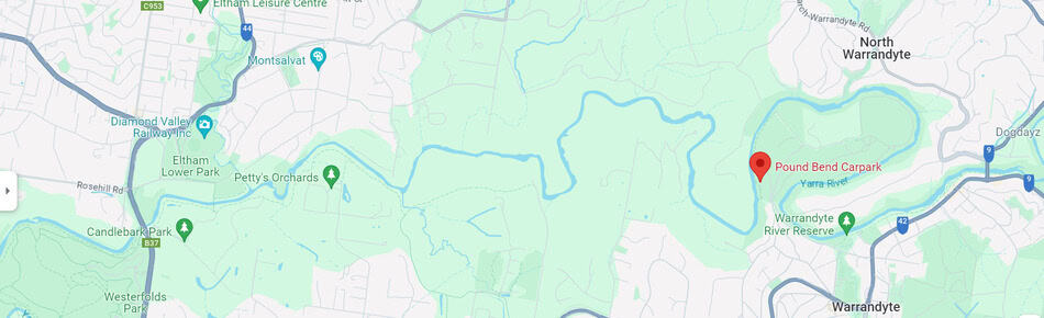
The Yarra River water levels were low as it was early Autumn, but not too bad; we didn’t have to carry the kayaks over any sections other than a fallen tree trunk. We thoroughly enjoyed plenty of small rapids without incident.
The river winds through bushland; for almost the entire paddle, it would be easy to imagine this could be almost anywhere in Australia, rather than heading to a major city. Giant gum trees with rope swings dotted the riverbank along the way.
We spotted a few kangaroos drinking by the edge of the river and relaxing in the shade. Platypus could be seen here at dawn or dusk.
At the end of this section of the river is a short kayak slalom training course that we passed through, as gracefully as possible, before pulling the kayaks out of the river below the bridge.
8. Westerfolds Park and Kayaking to Melbourne – To do!
We haven’t done this section of the Yarra River yet, so this is only a rough guide until it is completed and can be updated. If anyone has completed this section and would like to contribute details, please contact me.
- Location & Launch point at Westerfolds. Candle Bark parking area near the Kayak slalom training area.
- End Point – As a guide: Paddle distance one-way from Westerfolds to Bellbird Picnic Area where there is an easy exit point to nearby parking – 28 km approximately.,
- OR 15km (approximately) further to Powerhouse Rowing Club another easy exit point with parking nearby.
- Car Shuffle or Taxi back? It is approximately a 45-minute drive from Bellbird Picnic area to Candle Bark/Westerfolds.
- From the Powerhouse Rowing Club, it is approximately 5 km to SouthBank, then a further 10km down the Yarra and around to Sandridge Life Saving Club, where there is free parking.
Port Phillip Bay Kayaking
Port Phillip Bay is a vast body of water that should not be underestimated. People have been lost on the bay over the years. It is surprising how difficult it can be to find a small fishing boat that has been lost due to engine failure or the owner not correctly gauging the weather. Imagine being adrift in a kayak, canoe, or a SUP (stand-up paddleboard), possibly floating on an outgoing tide through the heads and beyond.
This section will gradually cover the entirety of Port Phillip Bay—section by section, and out into the bay, to various points of interest.
If anyone would like to contribute to writing about a section of the Bay that hasn’t been covered here, please email me.
▪︎Little Penguins at St Kilda Pier
Imagine launching a kayak from St Kilda Beach and paddling not too far out to see the Little Fairy Penguins returning home to the breakwater at the end of the St Kilda Pier. Read more about the history of the Little Penguins, and how to view them from the pier, here.
We kayaked out on a lovely summer evening, and it was a lot of fun. The St Kilda Salt Festival was on, and the music carried across the water as we sat quietly waiting for the sun to set and the Fairy Penguins to return home to their nests. There was enough light to see the first penguins come ashore. As darkness fell, we could see lots of the penguins climbing and hopping over the rocks along the length of the breakwater.
The St Kilda Ferry people operate a Penguin viewing tour on Friday and Saturday nights (seasonal and weather dependent), so that’s another option. Viewing them from the water in a kayak is the best experience, though.
We launched from Pier Road and had direct access to the beach; it was a reasonable hike dragging the kayaks to the water as it was low tide. Paddlers can launch from several spots along the bay, depending on how much paddling they want to do to get there, keeping in mind that the return journey is in the dark. Take lights for your kayaks—map link to Pier Road (parking is not free).
▪︎South Channel Light & Seals
3km each way
Starting from the Rye Pier (parking time limits apply during summer months) or from the Tyrone Beach car park which is free with no time limits (preferred start).,
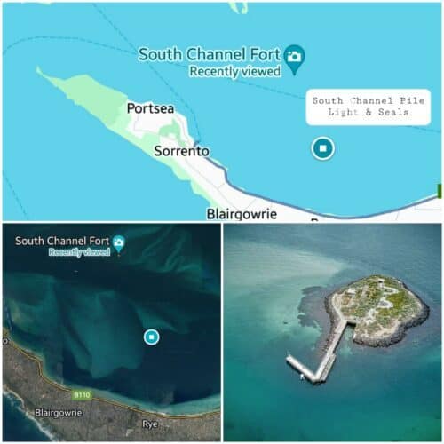
It is about 3 km to the South Channel Pile Light to see the seals lounging about on the 9m timber structure or frolicking in the water. If you are lucky, you’ll see a seal leaping out of the water onto one of the beams! There is no public access to the structure.
Heading out on an outgoing tide, timing the return to coincide with the turn of the tide or the incoming tide is ideal. Be careful, as always, to check wind and weather forecasts.
From the beach the South Channel Pile Light structure is just visible. As you paddle further out, it becomes easy to spot.
*As you begin the paddle, turn to look and get your bearings for the return paddle. The Rye pier is reasonably easy to see from a distance, so it’s not too hard to navigate the way back. We recently bought a good set of binoculars, which makes it easier to spot landmarks!
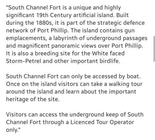
▪︎South Channel Island Fort (including Australian Fur Seals on the way)
14km return approximately
Continuing from the South Channel Pile Light and seal watching, as detailed in the notes above, a paddle to the South Channel Island Fort is an excellent day out!
Starting from the Rye Pier (parking time limits apply during summer months) or from the nearby Tyrone Beach car park, which is free with no time limits (preferred start).
Just over 4km further out on the bay, from the South Channel Pile Light and the seals, is the South Channel Island Fort, an ideal goal for a full day of paddling for adventurous paddlers. 😁
It is a fabulous addition to a day of paddling, firstly seeing the seals, then continuing to the fort. We found it easy to get onto the island. Pulling up beside one of the ladders that extends down below the water level, and pulling ourselves up. Our kayaks all had ropes, making it easy to hold onto them and then secure each one to the pier.
Climbing back down the ladder and back into the kayaks proved no problem either. It was a lovely, calm day, so this helped, as trying to do the manoeuvre on rough water might have had a different result!
A picnic at the end of the pier would be fun, not actually on the Island Fort, though, it is rather pungent!

▪︎Chinaman’s Hat, Seals, and Mud Island
19 km return approximately
Free Parking, Sorrento. At the end of St. Paul’s Road, the Sorrento Front Beach is an ideal launch spot. Parking is free, and it’s a short walk to the water, BBS, and toilets.
Launching from Sorrento, this was not intended to be a mud paddle! It was one of the most amusing paddles I’ve experienced, and it definitely needed to be done with good company.
We headed out, past the Sorrento Pier, to the historic shipping channel marker known as Chinaman’s Hat, a favourite haul-out spot for Australian Fur Seals. The Scuba Doctor has an interesting write-up on the structure’s history.
Tides and paddling- We paddled out on the last of the outgoing tide so that the return would be easy on an incoming tide. However, this meant we were at Mud Islands Bird Sanctuary when there was not enough water to paddle in easily, and we hauled the kayaks part of the way, mistakenly thinking there was an opening on the sandbank further down. Note: Always look at the terrain image on Google Maps!
The seals are always fun to watch, and dolphins will often be seen along the way.
From Chinaman’s Hat we headed to the southern end of Mud Islands, the most extensive sandbank visible in Port Phillip Bay.
The birdlife is prolific; on a calm day and with the right conditions, the reflections on the water are incredible. Again, the Scuba Doctor has an informative write-up.
The return paddle to Sorrento was simple enough, as the coastline could be seen easily. All up, we spent about four hours on the water. A picnic lunch on one of the beaches of Mud Islands would be a perfect stop.


▪︎ The Pope’s Eye, Chainman’s Hat and Mud Island
Ferry from Sorrento to Queenscliff and return paddle
17.5 km approximately
Free Parking, Sorrento Front Beach, near the end of St. Paul’s Road. This free, all-day parking area makes for a simple 800m kayak pull down to the ferry terminal. $21 as a foot passenger across to Queenscliff, with the kayak coming along for free.
Prebook a ferry ticket or buy one on the day. On arrival at the ferry terminal, join the car queue; tickets can be purchased from the ticket office as you walk through.
When returning, either repeat the walk up from the ferry or land on the beach near the car park. Before heading off, maybe walk down on the beach to get your bearings for the return. There is a toilet block near the car park, and a couple of BBQs too.
Kayaking to the Pope’s Eye on Port Phillip Bay must be the best paddle on the Bay.
Finding an ideal day when the tide is rising and the winds are favourable is the tricky part.
A solo mid-winter paddle was thoroughly enjoyable; sitting quietly at the Pope’s Eye, with seals playing around the kayak, was a hoot. The seals see a lot of human traffic out there and show no fear, almost revelling in leaping into the water to check out visitors!
The paddle from this point to the structure known as Chinaman’s Hat was straightforward, as it was visible in the distance.
Young Australian Fur Seals were lounging around, and a few came over to check me out. They are used to human company and rarely seem to show any fear.
Mud Island is also visible in the distance, another cruisy paddle across and some time spent on the beach, brewing up a cuppa and enjoying the serenity.
- Queenscliff Ferry Terminal to Pope’s Eye – 2.6 km
- Pope’s Eye to Chinamans Hat – 3.1 km
- Chinamans Hat to Mud Island – 3.6 km
- Mud Island to Sorrento – 8.2 km
** This paddle needs careful planning. Winds and tides can bring on dangerous conditions. Sit-on-top and inflatable kayaks are not ideal for this paddle. Please make your own assessments based on experience, skill, and weather forecasts.
1. Williamstown Beach to St Kilda or Port Melbourne
15 km return approximately Williamstown Beach to St Kilda Beach
10 km return approximately. Williamstown Beach to Sandridge Beach, Port Melbourne
Start/Finish- Parking at Williamstown Beach is easy; launching from the beach is a breeze. Alternatively, park at St Kilda Beach or Sandridge Beach Life Saving Club if it is easier, depending on the direction you are coming from.
- Parking is ticketed at Williamstown Beach & St Kilda Beach; parking at Sandridge Beach is free.
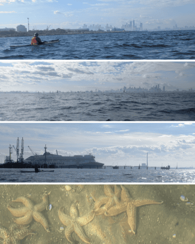
This is a fabulous kayak paddle, my favourite part was on a bit of a diversion, paddling between the pylons of the old Princes Pier and then underneath Station Pier. At the very end of Station Pier, it warns not to get within 30 metres, but there are no further warnings as you approach the pier, closer to the beach. Presumably, it was ok. Certainly was fun under there!
I parked at Sandridge Beach, paddled towards St Kilda Pier, passing Princes Pier and Station Pier, then returned to meet the group at Sandridge Beach and across to Williamstown Beach, adding 6/8km or so to the trip.
2. St Kilda Beach to Brighton Yacht Club/Sea Baths
6 km each way, approximately
Start/Finish – Parking at either end of the paddle is available at a cost, with metered parking or a bit of a walk if parking in a neighbouring street.
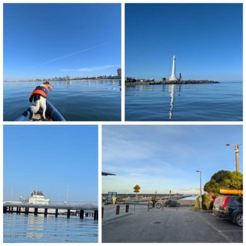
We parked by the Middle Brighton Sea Baths/ Royal Brighton Yacht Club in a 4-hour zone, which allowed plenty of time to paddle up to St Kilda Beach and return. There is a cafe there, making it a handy spot for a meal or a cuppa.
Tip – The paid parking zone at the Sea Baths starts at 8 am. If you park before this time and pay at the meter, the 4-hour paid time will automatically begin from 8 am, giving added time for a paddle before the parking expires. Fab.
This is quite a fun section to paddle with cafes at both ends and a terrific dog-friendly beach near the Brighton Sea Baths, so for anyone taking their pooch along, there is more fun to be added to the paddle.
3. Brighton Sea Baths/Yacht Club to Sandringham Yacht Club (to be added)
5km each way, approximately
Start/Finish – Both ends of this paddle involve paid parking or finding a free spot in neighbouring streets. The Brighton Sea Baths are a good launch spot, with a great cafe on the foreshore or park near the Sandringham Yacht Club Jetty Road, Sandringham. There is a cafe here, generally open from 9 am to 3 pm.
It’s a pleasant paddle; the highlight is passing by the beautiful bathing boxes on Brighton Beach. It is easy to stop here for a walk along the beach to have a close-up look. Pack a picnic, maybe or indulge in a meal at the Dendy Beach Pavilion, situated at the city end of the bathing boxes.

4. Sandringham Yacht Club to Ricketts Point Marine Sanctuary
9km each way, approximately
Start/Finish– Ricketts Point Marine Sanctuary (easiest to launch) or Sandringham Yacht Club. Both involve paid parking.
This fab paddle has the bonus of a cafe at both ends, and in the middle of the paddle, at Black Rock Yacht Club, there is a cafe and the Cerberus Beach House restaurant!
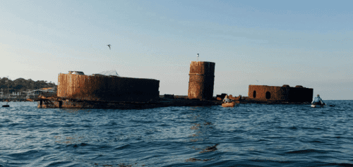
Views of gorgeous, red cliffs, sandy beaches and the HMVS Cerberus, Australia’s only intact colonial warship, which never saw action before being turned into a scenic wreck; good fun to paddle around.
5. Ricketts Point Marine Sanctuary to Patterson River, Carrum
15km each way, approximately
Start/Finish – As parking is paid or available on the road at Ricketts Point, our preferred starting point is to launch from the Patterson River boat ramps. Parking is free, and it is easy to launch from a small sandy beach area to the left as you enter the car park.
Paddle down the river, under the road bridge and out into Port Phillip Bay. Turn right and follow the coastline around to Ricketts Point. It’s a great paddle with spectacular views of the cliffs near Beaumaris.
It would be easy to do a car shuttle and paddle one way rather than return.
6. Patterson River to Oliver’s Hill Beach, Frankston
9.5km each way, approximately
Parking is free at the Patterson River boat ramps and at Oliver’s Hill boat ramp and pier, making this paddle easily accessible from either location.
There isn’t a lot to see along the way, though there’s the opportunity to stop in at one of the life-saving clubs for a cuppa and a snack or pull up at the Frankston pier. Have a swim on a lovely day, plenty of beachfront to choose from.
7. Oliver’s Hill to Mornington Pier
10km each way, approximately
Start/ Finish: Oliver’s Hill car park and boat launch ramp, free parking with no time limits. There is often a fish-and-chips van and/or a coffee van operating.
Launch from the boat ramp, pier or from the beach, as there is a gap in the stone wall with steps down onto the beach from the left-hand end of the car park.
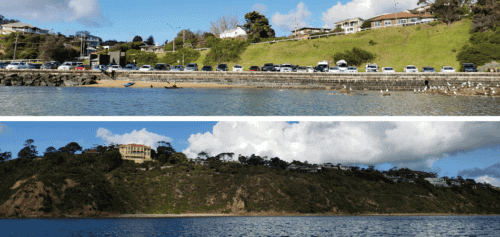
It is a good kayaking trip with great views of homes perched up on the cliffs, passing Mt Eliza and several beaches. There is a cafe at Schnapper Point (Mornington Pier) plus toilets. It is all paid and time-restricted parking by the Mornington Pier, so Oliver’s Hill is the better starting point.
8. Mornington to Mt Martha Beach Kayaking
7km each way, approximately
Start/Finish: Mt Martha beach. Free parking, toilets, BBQs to use, a pretty beach and colourful beach huts. The trip could start from Mornington Pier (Schnapper Point), but parking is paid, and spaces are limited.
I paddled along the coastline, watching birdlife all the way to Mornington Pier, then paddled a bit further out on the return paddle.
Tethering the kayak to one of the buoys in Mornington harbour, lunch that I had brought along with me was enjoyed whilst bobbing quietly on the water. I generally have a rope tied to both ends of my kayak; it’s very handy for tethering to face in whichever direction is the most appealing.
Watch out when paddling past the concrete wall of the Mornington pier, as the waves crashing into the wall can create a rather turbulent paddle if you are too close!
Dolphins and stingrays can be seen at times if you are lucky. When the water is really calm, it’s possible to see huge starfish down below.
9. Mt Martha Beach to Dromana
10km each way, approximately
Parking at Mt Martha Beach or in Dromana is free, so start the paddle from either location. Mt Martha Beach is a lovely spot with grassed picnic areas, free BBQs, and toilets.
This kayaking trip is fun, passing beneath cliffs with great views, along past Tassells Cove and the dog-friendly beach, then onto Dromana Beach.
When we paddled this route, it was a public holiday, and every type of watercraft was out on the bay; it was amazing to see.

10. Dromana to Tootgarook
9km each way, approximately
Start/Finish from either Dromana Beach or the Tootgarook boat ramp, parking is free in both locations.
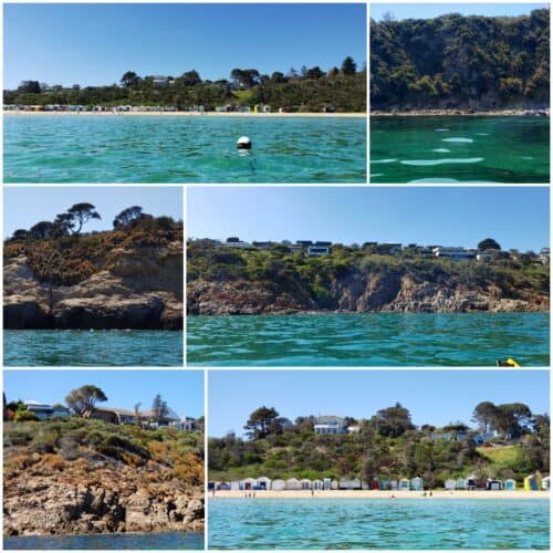
This is an easy kayaking trip to do on a calm day, with no big cliffs, but it is fun, especially in the summer months when people dot the beaches and boats are out. The water is shallow close to shore, and there are numerous spots along the way where you can swim.
11. Tootgarook to Sorrento Kayaking
11km each way, approximately
Start/Finish at either Tootgarook boat ramp or Sorrento Front Beach; both options have free parking.
This is another cruisy kayaking adventure, in good weather. Passing by yacht clubs and piers. The Blairgowrie Pier is excellent to stop at—a fantastic beach, restaurant, and toilets.
People jump off the pier into the water, enjoying a perfect summer, and beneath the pier, the sea life is fabulous. It’s an ideal place to snorkel, with Seahorses, sponge gardens, and an abundance of sea life.
From the pier, pass by the yachts moored, below the White Cliffs to Camerons Bight Foreshore camping area, around the cliffs, and onto Sorrento Front Beach.
12. Sorrento to Point Nepean National Park Kayaking
19km return approximately
Start/Finish– Sorrento Front Beach (free).
This was a fantastic kayaking trip. Starting from Sorrento, passing Portsea, and continuing all the way to the Point Nepean National Park.
The video, below, features the return kayaking trip, with fabulous views of rocky cliffs, hilltop mansions, secluded beaches, boats, and jetties.
The water was crystal clear, the weather ideal for a mid-winter kayaking trip on Port Phillip Bay.
I pulled the Kayak onto the beach a few hundred metres beyond the Quarantine Station buildings, then walked 100m or so to the point and looked out at the rip, where Port Phillip Bay flows into the Bass Strait.
It’s a beautiful part of Victoria and one of my favourite kayaking destinations near Melbourne.
Lunch on several secluded beaches is possible, or you can pull the boats up at Portsea and have lunch at the pub.
I tethered my kayak out on the water and enjoyed lunch on board, taking in the view, the birds, and the gentle rocking.
This is the best paddle on the Bay!
Mornington Peninsula – Westernport Bay, Shoreham to Flinders
10 km return approximately
Start/Finish – Shoreham Beach (Free)
From Shoreham Beach along to the Flinders Pier is a fairly nice paddle. Views across to Phillip Island (approximately 13 km away) and the Nobbies make it interesting looking in that direction, and along the Mornington Peninsula side, the hills rise up steeply with bush, farms and big, open paddocks. There is no cafe at the pier, and the walk into the town of Flinders would take about 20 minutes for anyone wanting a snack.
I drove into Flinders after the paddle and indulged in an ice cream with three decadent flavours from the little Chocolaterie shop. There is a lovely parking area overlooking the bay, heading towards the jetty. It was a good spot to park and scoff my ice cream.

