
Updated on August 22, 2026
Victoria offers some of the best kayaking choices in the country. From rivers and lakes to spectacular coastal paddles, there is a lot to see.
Melbourne and the Great Ocean Road both have some fantastic spots to paddle. Several lakes can be accessed easily from the suburbs of Melbourne, plus the Yarra River and Port Phillip Bay. Head out beyond the big city though, and wild rivers as well as calmer, more sedate rivers and lakes are plentiful.
Gippsland Lakes, Bunga Arm & 90 Mile Beach – Solo Camping
- Paynesville to Albatross Campsite, Bunga Arm via Sperm Whale Head – 17km one-way approximately
- Albatross Campsite, Bunga Arm to Paynesville direct – 11km one-way. Half the distance involves crossing the lake, then paddling the rest of the way up the inland waterway.
- Parking in Paynesville – Most of the parking areas by the water are free and not time-restricted. I parked off the Esplanade, here.
- Book Bunga Arm Camp areas through Parks Victoria.
- Parks Vic Map of Bunga Arm Camp areas
- No dogs allowed.
Bunga Arm, a 250-metre sand barrier formed over thousands of years, separates the Gippsland Lakes from 90-mile Beach and the Bass Strait.
This kayak trip was in an inflatable from Razor Kayaks, the Edge Pro 1. It’s a great boat, easy to inflate, shaped like a hard-shell kayak, and with plenty of storage space for the camping trip.
Armed with the knowledge that mobile reception is available out at Bunga Arm, I didn’t pre-book a campsite. After paddling across to the camping areas via Sperm Whale Head (which lengthened the trip considerably but was ok) and then paddling by each of the seven campsite options: Gannet, Pelican, Egret, Albatross, Shearwater, Cormorant, and Dotterel – Albatross was the clear winner! Shearwater would be the second choice, a school group were using it at the time, so I didn’t browse the sites, but there was a picnic table visible from the water.
Each of the seven sites is not too far apart, but secluded, with fire pits to share, some tables, and good, clean composting toilets. Each one is just a short walk across to 90 Mile Beach.
The sites are clearly sign-posted and visible from the water. They are all sheltered and have plenty of shade. Albatross was the only one with water views, not from all the sites, just from sites 1-4. The access to these sites is just past the sign-posted entry point.
Apart from two school groups at other sites, there was no one else out camping. I had Albatross to myself! Site no 2 was booked online easily, and the mobile reception was good. This site was closest to the shared table and fire pit. Coffee was brewed, I got the fire set up to light (BYO wood), then took a 5-minute walk across the tree-clad dunes, and stood on the famous 90-Mile Beach.
It was a gorgeous evening in an idyllic location. Nothing but the sounds of wildlife and the ocean.
Gippsland Lakes, The Silt Jetties
- Eagle Point to the tip of the Silt Jetties – 8km one-way approximately
- From the tip of the Silt Jetties to the crossover point at the boat ramp – 6km approximately
- Boat ramp to Eagle Point Foreshore – 1km
- Total round trip – 15km
- Camping/cabins/caravans – Eagle Point Campground
This is a truly special spot in Victoria. The Silt Jetties can be experienced from the water or by land.
Kayaking is an ideal way to experience the incredible region of the Gippsland Lakes.
The Mitchell River Silt Jetties are a spectacular natural feature where the Mitchell River meets the Gippsland Lakes.
They are formed by over 8 km of naturally deposited silt, they the longest silt jetties in the world.
Leaving from the beach at Eagle Point, where it was a minutes walk from the caravan park, we launched at sunrise.
Approximately 8km out to the Silt Jetties, with a glorious sunrise, reflective calm water, and pelicans. A fantastic early morning paddle with the dog, Maisy.
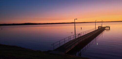
It was easy to tether the kayak to the small pier at the end of the Silt Jetties, then scrambled eggs and coffee were cooked up on the JetBoil stove.
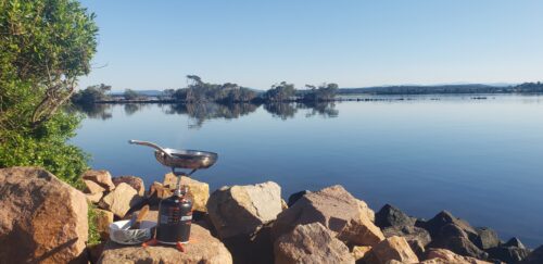
Heading up the Mitchell River, through the Silt Jetties, it was so calm, just perfect.
Approximately 6km up the Mitchell River is a boat launch area where it’s possible to carry kayaks across to the other side and relaunch for the 1km paddle back to Eagle Point Foreshore.
….or continue kayaking upriver to Bairnsdale. That trip is for another day.🌞
Gippsland Lakes, Eagle Point to Paynesville
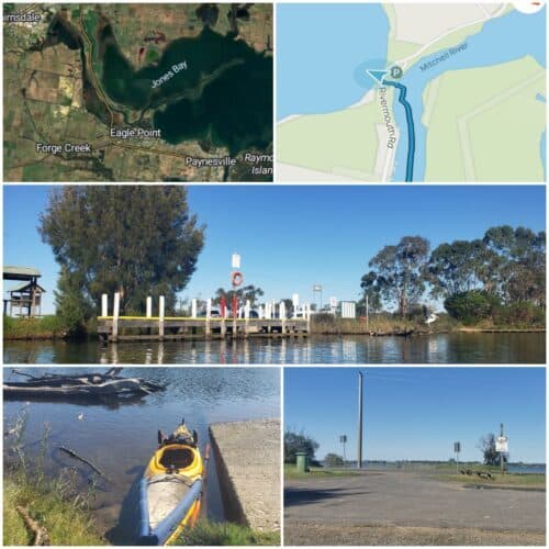
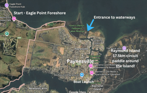
- Departing from Eagle Point to Paynesville, approximately 15km return.
- Raymond Island circuit – 17.5 km approximately.
- Camping/cabins/caravans – Eagle Point Campground
Another glorious sunrise and early morning kayak trip with the dog. This was a direct paddle, heading right from Eagle Point towards Raymond Island and Paynesville.
There is a long, narrow piece of land to paddle around on the way, the Point Fullerton Reserve. It is easy to see in the distance and has some sweet sandy beaches to pull up on.
After going around the tip of Point Fullerton, the entrance to the waterways of Paynesville can be seen. Paddle on in, passing by boats and waterfront homes all the way to the town centre.
We pulled up opposite the Paynesville shops on Raymond Island, home to a handful of human residents and a good number of Koalas. There was a sweet little coffee van, a hub for the locals and very friendly. After a cuppa and a walk around the island, the paddling continued.
Heading directly down the passage between Raymond Island and Paynesville, back to the campground at Eagle Point.
A circuit around Raymond Island has been reserved for another day; it is approximately 17.5km (whole island circuit), though it could be added to this trip.
Gippsland Lakes, Kayaking at Lakes Entrance
- Launch and return point from the car park off Marine Parade, Lakes entrance. Google map directions.
- Return distance 9.5 km approximately
This was a leisurely kayaking trip, leaving from a sandy beach along the North Arm and heading left, under the bridge and to the left around Bullock Island. Take care of currents and check tides.
We pulled up on the far side to walk out to Seals Lookout and see the Lakes Entrance passage where the ocean meets the Gippsland Lakes. It’s a rough bit of water and not a place to kayak without plenty of experience, so we stayed on the gentle waterway into the harbour!
It’s a lovely paddle, passing by fishing boats, with access to walk over to the famous Ninety Mile Beach or pop into a cafe.
Blue Rock Lake and The Tanjil River, West Gippsland
- Google Map Directions to Blue Rock Lake Boat Launch
- Return paddle to first rapids encountered on the Tanjil River, 18.9 km approx.
- Toilets, swimming, dogs allowed, playground and BBQs.
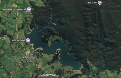
Just under a 2-hour drive from the centre of Melbourne is Blue Rock Lake, with access to the pretty Tanjil River.
The main boat launch area has a boat ramp and a pier that make it easy to launch a kayak or canoe.
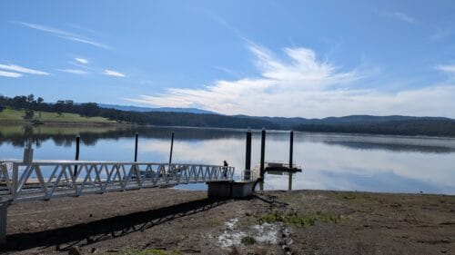
From the launching area, paddle straight ahead across the lake. It is approximately 2 km across to the more sheltered sections of the lake, paddling amongst tree trunks that still stand after the lake’s 1984 flooding.
Continue paddling until you join the Tanjil River, which narrows and is surrounded on both sides by dense forest. A few opportunities are possible to land and stretch your legs along the way.
I laughed at the sight of a ‘Nooj Pub’ sticker adorning the back of what appears to be a road sign, plonked near the water’s edge with no visible access.
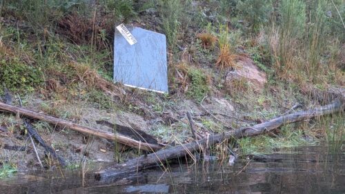
It was amusing to come across a fabulous area used by lucky campers to relax by the river; a sign declares it ‘Rock’s Shack’. It is about 300 m beyond this point that a small set of rapids is encountered, and it is a turnaround point. Unless, of course, anyone fancies a portage over the rocks and an exploration further upstream.
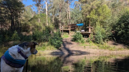
Blue Rock Lake and the Tanjil River are worthy destinations for a paddle with plenty of birdlife and pretty scenery.
South Gippsland, Powlett River
- Google Maps directions to the Powlett River parking area.
- Return Paddle, going as far as the Bass Highway Bridge, 14.5km.
- Powlett River Holiday Park – Powered/unpowered sites and cabins.
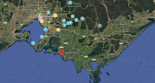
The Powlett River paddle was better than expected. It started as a reasonably wide river, then narrowed and became quite overgrown, with a few bushes to negotiate before reaching as far as it was possible, where the Bass Highways crosses over.
Heading upriver, I caught up with two other paddlers, and we all went as far as an old wooden bridge that is now a section of the Bass Coast Rail Trail.
The other paddlers turned back, but I kept on going, determined to paddle as far as possible! Doing the ‘kayaking limbo’ under numerous low-hanging branches, a bridge where the Bass Highway crosses the river was the turning point.
It was definitely worth paddling the distance; the bird life was abundant, and it was pretty tranquil.
Passing by the car park, it was a fun, short paddle to the ocean beach where the waves were crashing in as the sun began to set. An ideal spot to have a drink and watch the ocean.
Murray River Kayaking- 50 kms Barmah to Echuca
- Barmah to Echuca on the Murray River – 50kms.
- Barmah Bridge Caravan Park to Echuca driving – 25 mins/ 30 kms.
- Rich River Taxi $70 approx. Ph. 0447902279
- Parking opposite the Police Station, Anstruther Street, Echuca (at own risk).
- The trip finished just under the bridge in Echuca, a 500 m walk to the cars.
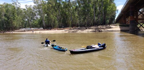
A few of us did this fun kayaking trip over 2.5 days, leaving from Barmah at about 5pm on the Friday. It was a leisurely 50 km paddle with two free camp stops and plenty of swimming along the way.
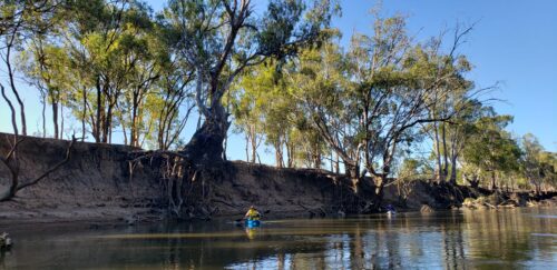
Ideally, a full 3 days would have been perfect to allow for lingering longer. But it was a fun trip with great friends, and not strenuous.
I was able to go a day early, loaded up with the 3 kayaks, and stayed overnight at the Barmah Bridge Caravan Park. It is a great caravan park located on the banks of the Murray River, featuring a mix of permanent onsite holiday vans and powered and unpowered camping sites.
The owners are fabulous, friendly people and were kind enough to let me leave the three kayaks and gear there, as I had been a guest, whilst I drove down to Echuca to meet my friends.
We left the cars in Echuca, opposite the police station, and then caught a pre-booked Rich River Taxi (0447 902279) back to Barmah. For around $70, it was worth the expense so we didn’t need to do a car shuttle back up to Barmah at the end of the trip.
The first night, we free-camped about 2 km from the Morning Glory Resort, having paddled about 10 km. The resort would be a good option for accommodation or camping if preferred.
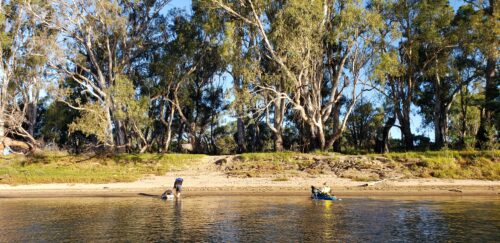
Leaving about 9am or so the next morning, we paddled about 25 km in all.
Not fast, just a cruisy paddle with a convenient lunch stop at the Cape Horn Vineyard and Riverside Bar. It was a welcome sight as we paddled down the river, with a pontoon to tether the kayaks and a big, dog-friendly eating area.
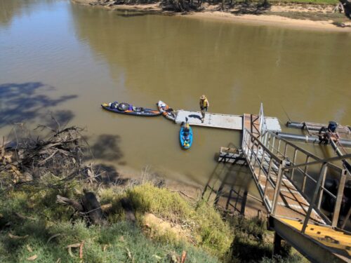
Our second night camping was just past Christie’s Beach. We would have pulled up at Christie’s, but a large group of happy campers were looking likely to have a fun evening, and we felt that paddling on a short distance would be prudent for a quiet evening.
Cars can access Christies, as well as many of the campsites along the way, which makes it easy for anyone wanting a vehicle backup.
The spot where we stopped was lovely, although it required a small climb up an embankment from the beach to reach the camp.
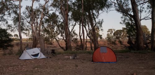
We discovered that while it was fun to ride the wake from speedboats and jet skis out on the river, trying to get ashore and unload the kayaks involved being flooded by the waves as they broke on the shore.
One had to be swift to unload/load between passing boats!
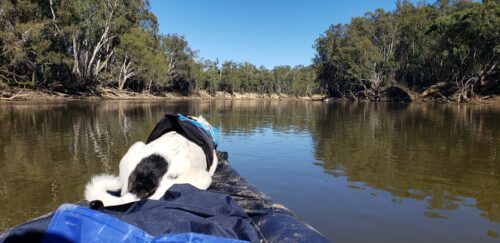
Mud! We also discovered that not all sandy spots are as they seem. Where the river runs slowly, the silt seems to build up, and it can mean standing thigh-deep in mud if one exits their yak. Beaches on bends in the river seem to avoid this minor problem, according to a local.
The Pevensey paddle boat chugged past us on our way into Echuca; what a grand sight to see it upriver.
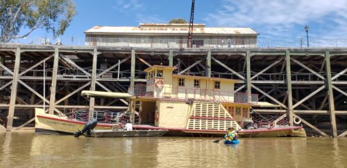
When we reached the main bridge in Echuca, two of us clambered out onto the rocks to walk the 500 metres to collect our cars and then drove across to Moama Beach on the N.S.W. side to pack up, as it was a better spot.
Our third paddler towed the kayaks across the river to meet us there. A plan well executed.
Overall, this was a wonderful kayaking trip with great friends. More Murray River paddling to come!
Next trip on the mighty Murray? Tocumwal to Barmah? It sounds like a beautiful section to paddle.
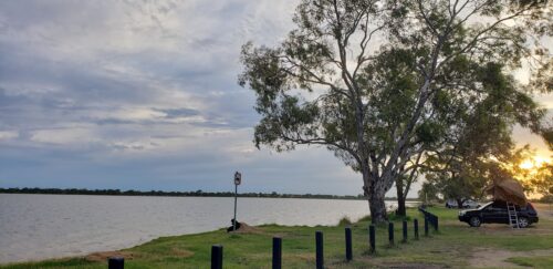
I had an extra day up my sleeve, so I made an overnight stop at Greens Lake free camp, a fantastic camping area beside a large lake with very hot (and free) showers and toilets.
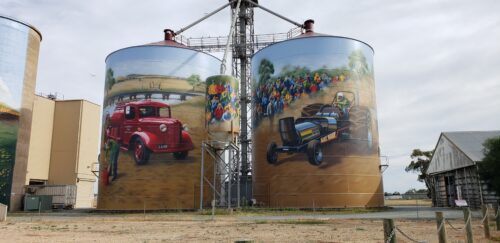
Then a stop the day next to see the painted silos at Colbinabbin before lunch at the Murchison Bakery.
Gunbower Canoe Trail & Gunbower Creek
- Koondrook/Gunbower Canoe Trail, (Google maps link) and launch ramp with rollers. Terrific fun to launch at this spot!
- Koondrook Track public boat ramp (Google map link). This area is ideal for free camping and launching, with toilet facilities available. From this spot, launch at the public ramp and paddle down Gunbower Creek to the canoe trail and canoe launch site. Have a go at using the ramp, it’s good fun.
- Free camping is permitted in the Gunbower Forest; there are plenty of awesome camp sites by the river and near the canoe launch.
- The Gunbower Island Canoe Trail is located in the beautiful wetlands of Safe’s Lagoon, on Gunbower Creek. From the launch, turn right and continue straight ahead for the 5km return paddle.
- Paddle Gunbower Creek – From the canoe launch, head to the right and then right again. It is about 11/12 km upriver to the weir and back. Or head left and paddle as far as you want; the Gunbower Creek flows into the Murray River, quite a few kilometres away. It would, perhaps, be a good multi-day trip.
- More paddle ideas can be found here. There are plenty of places to explore!
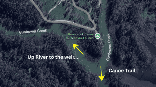
Launching down the roller ramp was fun, quite an amusing way to enter the water. The river levels were at their best for paddling due to recent rains. The launch would be faster when the water is lower. Pulling oneself back up the launch was quite easy, and amusing, too.
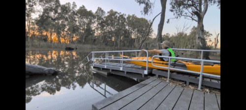
The Gunbower Canoe Trail in Safe’s Lagoon is stunning, with lots of birdlife and fish. Paddling upriver to the weir was delightful, too, passing by a few farmhouses and the larger camping area. From the canoe launch, turn right and paddle straight ahead.
I camped close to the launch site. There are many choices of riverside campsites. The road in is unsealed and can get muddy after rain. Generally, though, it is fine for 2 wd vehicles.
Lake Nagambie and paddling to Kirwans Bridge
- Google Map link to the launch area, Turner Island Lane, Nagambie.
- Major Creek Free Camp Area – Google Map Link.
- Launch area to Kirwans Bridge and return – 3.6 km.
- Launch area to Lake Nagambie, turning around near Teddy Bear Island, about 2km before the town – 10km return.
Nagambie had been on my radar for some time after seeing idyllic photos shared of the waterways, Kirwans Bridge and birdlife. It didn’t disappoint either.
Parking at the launch area, and heading to the right, it was a short paddle to see the historic Kirwans Bridge. The bridge is currently closed to traffic, and I hope it will be repaired and preserved for future generations.
Turning around at the bridge, to head towards Lake Nagambie, passing by the launch area again, I paddled on down towards the town of Nagambie. It would have been maybe 2 km further to get to the town, but I opted to return just past Teddy Bear Island, which was full of fruit bats squarking away to the car and make a cuppa, yacking to the returning fishermen about their results for the day.
The Major Creek free campground was a fabulous spot to stay for a night. Parked by the river, a Monitor Lizard swam across to a dead tree trunk and climbed up, sunning himself. Lots or birdlife and fish jumping too. It’s a basic camp with toilets and camp fires are allowed. It’s close to some major wineries and about a 15 minute drive from Nagambie.
There are a lot of paddling adventures in this area, heading upstream or down on the Goulburn River… another time!
Lake Eildon, Jerusalem Creek Camp Ground & Kayaking
- Google Map link – Jerusalem Creek Campground No.2
- Nearest restaurant – Jerusalem Creek Marina. Paddle (1km approximately) or drive (2.9km).
- A map of the camping sites can be downloaded here.
- Boat hire and other activities info here.
Lake Eildon is massive, and perhaps a little daunting to explore by kayak. I headed to Jerusalem Creek campground after spending a few days at Sheepyard Flat, managing to get a paddle in before torrential rains hit.

Jerusalem Creek campground, just south of the township of Eildon, is a low-cost site managed by Parks Victoria. It consists of 8 dog-friendly camping areas with basic amenities. Toilets and firepits are provided; bring your own wood.
A little like Goldilocks and the Three Bears, I drove into the first camping area and saw no easy water access for the kayak. Then into camping area 2, where the perfect spot was available. Site 19. Payment is online, reception is poor. Best to pay prior to arrival.
It was a quick bit of kayaking fun on Lake Eildon, with the dog, departing from camping area 2.
Past some dead tree trunks and reeds, out onto the open lake and across to the Jerusalem Creek Marina to have a look at the houseboats.
The lake was like a mirror, reflecting the clouds; it was stunning. We returned to the campground, and I managed to pack the kayak and other gear away just moments before the storm hit. Great timing.
Lake Eildon Kayaking and Free Camping
- Parking at the main boat ramp of the Lake Eildon National Park,
When I write ‘free camping’ on Lake Eildon, it was on the water on the Lake, in my inflatable Razor Kayak! The kayaking weekend was planned with friends, but they had to pull out, and so I decided to go solo.
Parking at the main boat ramp of the Lake Eildon National Park, inflating the Razor kayak and launching late afternoon, it was a leisurely 6.5km paddle out towards the Mountaineer Inlet free camp.
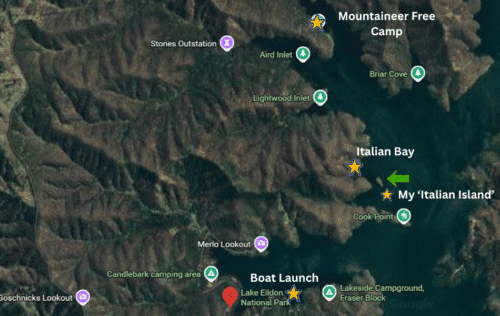
I had read some good reviews about the Mountaineer free camp, which is accessible only on foot or by boat. It failed to impress me; the water level was a bit low, so there was some mud to trek through, but that was ok.
Mountaineer Inlet campground left me rather unimpressed: biting ants, uneven, wonky ground for pitching a tent, and, worst of all, discarded toilet paper and filth left by inconsiderate visitors. Someone had actually written a warning on an old boogie board. The most impressive part of the campground was the composting toilets, which were clean and tidy.
I’ve since found out there is a small area to the right of the Mountaineer campground sign that’s better for camping, close to the water and away from any mess.
I made a hasty retreat to the kayak after checking out the campground, paddling off into the sunset towards Italian Bay, which I had passed on the way.
The revised plan was to find a little beach to pull up on and camp, easier thought about than done, though! The evening sun was warm and the colours on the hills beautiful. I passed by a few houseboats, and one owner called out to check if I was lost – no, just looking for a camp.
Near Italian Bay, there is a tiny island, seemingly unnamed, that was in my sights; I shall call it Italian Island. My Italian Island.
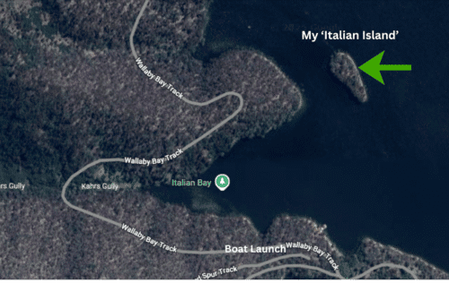
It really was a speck of an island on the expansive Lake Eildon, and suited me fine. There was nowhere actually to pitch a tent or hang my hammock along the rocky shoreline, but that was fine; it was at last my chance to sleep on the kayak! The Razor two-person inflatable is a good size for one camper. Narrow, but long enough.
Dinner was cooked on my JetBoil camp stove, with the lightweight camp table set up right on the water’s edge. My hiking chair was placed just in the water whilst I ate dinner to avoid injury – the biting ants had even got out to this little island and were everywhere! One must laugh at such things.
After dinner and a mooch around the shoreline, spotting a massive houseboat moored on the other side, I paddled out about 50 metres and tethered the kayak to a dead tree.
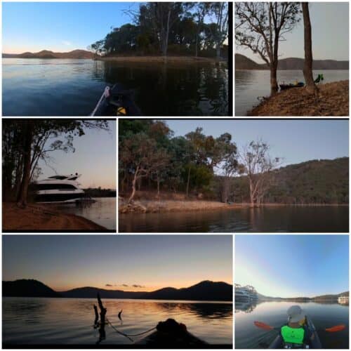
It was such a beautiful, starry night, and houseboats were motoring up the lake; it was the beginning of a long weekend. The sounds of distant motors could be heard for hours, till well after midnight, and the wake from the boats eventually reached my ‘floating bed’, rocking it gently.
I started listening to an audiobook, ‘Four Mums in a Boat – Talisker Whisky Atlantic Challenge’. The first few minutes of the audiobook made me laugh out loud, the sound no doubt carrying across the water. Here is a YouTube documentary of the mothers from Yorkshire who decided it was a grand idea to race across the Atlantic. The book is a great read or listen.
The next morning, after making scrambled eggs and brewing up a cuppa, I paddled around ‘my’ island, past the massive houseboat with a giant TV screen and slowly back to the boat launch.
Some paid and free campgrounds can be found around Lake Eildon, so plenty of kayaking options are available.
Lake Eildon. Bonnie Doon Paddle
- Launching from Bonnie Doon – 6km each way approximately
- Google map link to the launch area.
- This paddle can only be done when the Lake Eildon water level is really high.
My friend and I took off to do this kayak trip while the opportunity presented itself (April 2024). It is not too often Lake Eildon has such a high water level that it is possible to paddle up this section, as it is usually dry and a place for cattle to graze.
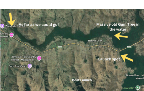
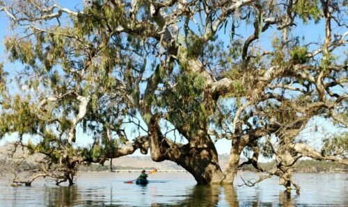
Once on the water, we headed left, under the bridge that spans to the lake and around the corner, passing a massive old Gum tree that was now its own island in the lake.
Cattle were grazing on the hills, and a few kangaroos were spotted, too. We paddled as far as possible before returning, as the sun was taking on a late-afternoon golden glow.